historicsf
A historic map of the SF Bay Area
Therea are reliabile surveys of the Bay Area going back to the late 1800’s. I created and documented a proceess to correct these sources, crop and stitch them together to create a complete overlay of the San Francisco Bay Area from the 19th century.
Interactive Map: external link
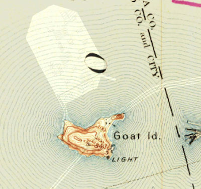
Looking at this map you can see the drastic change of bay shoreline from landfill, geoengineering, and the development of major cities or roadways
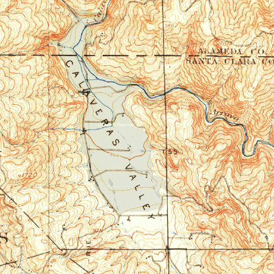
You can see the valleys that would be dammed for reservoirs
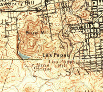
You can see old names for places (Las Papas - now Twin Peaks and Blue Mt, now Mt Sutro)
The Github Project demonstrates the process using a Makefile. This script shows how raster processing can be pipelined in the command line.